Points
The frame "Points" serves to define the coordinates of terrain points. There are two options available to define coordinates of individual points:
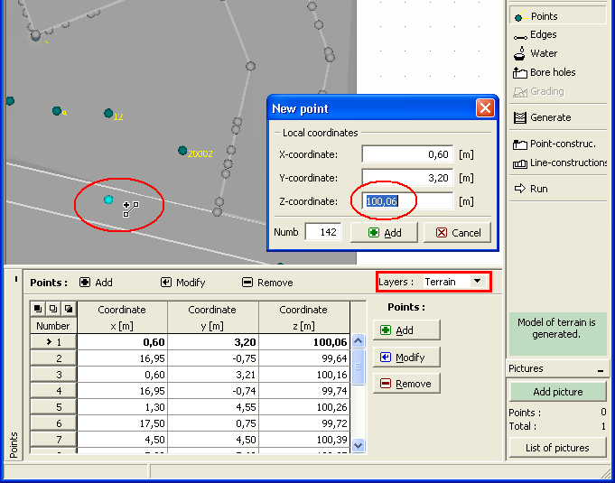
With the help of table: points are defined in the table. Pressing the "Add" button opens the "New point" dialog window; coordinates of points are then specified and by pressing the "Add" button added to the table. An arbitrary number of points can be defined in this way. The "Cancel" button is used at last to close the window. These points can be further modified (in the dialog window) using the "Edit" button or removed with the help of "Remove" button (more points can be marked in the table to remove them all at once - before removing, the selected points are displayed on the desktop in red). Each change is immediately reflected on the desktop.
With the help of the mouse: this inputting mode is turned on by pressing a respective button on the horizontal bar. The following options are available:
Add |
|
Edit |
|
Remove |
|
Select |
|
The selected points can also be imported from files in formats TXT, Atlas DMT, DXF and LandXML.
The program allows for importing further points and edges into the processed task (e.g. in subsequent stages).
When defining points the program in some cases automatically calculates their Z-coordinates. Only one point can be assigned to a single coordinate X, Y.
Providing the option of inputting layres with the help of "Points of layers" in the "Basic data" frame is selected, the "Points" bar contains the "Layres" combo list. This list serves to choose a layer into which the points will be input.
Visualization of drawing on the desktop can be modified in any input regime based on the setting adjusted in the "Drawing Settings" frame and with the help of buttons on toolbar "Visualization".
 Frame "Points"