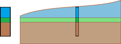
Geological Model with Horizontal Layers
We will create a geological model with horizontal layers according to the following picture.
First, we enter a field test (type borehole) in the "Field Tests" frame - the name BH 1, coordinates [x; y; z] - [5; 5; on terrain], thickness of layers [2; 1; 3].
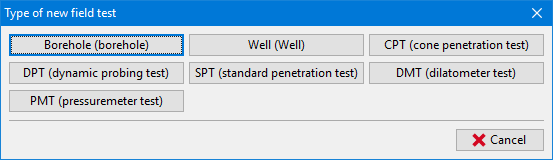 Selection of field test type
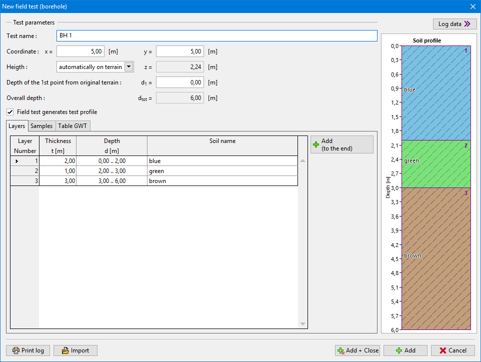 Borehole input
The soils [blue, green, brown] can be added directly in the window "layers of borehole" or in the "Soils" frame. The easiest way is to copy all soils from the tests using the "Adopt from field tests" button. The list of soils used in tests is created.
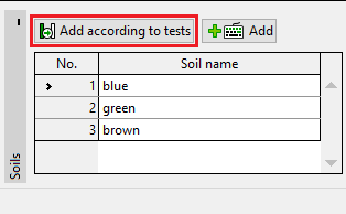 Adding soils according to tests
The soil profile and borehole are created automatically from the test (type borehole). After switching to the "Geological model" frame, the required model is generated (if the manual generation is selected in the "Settings" frame, it is necessary to use the button "Generate").
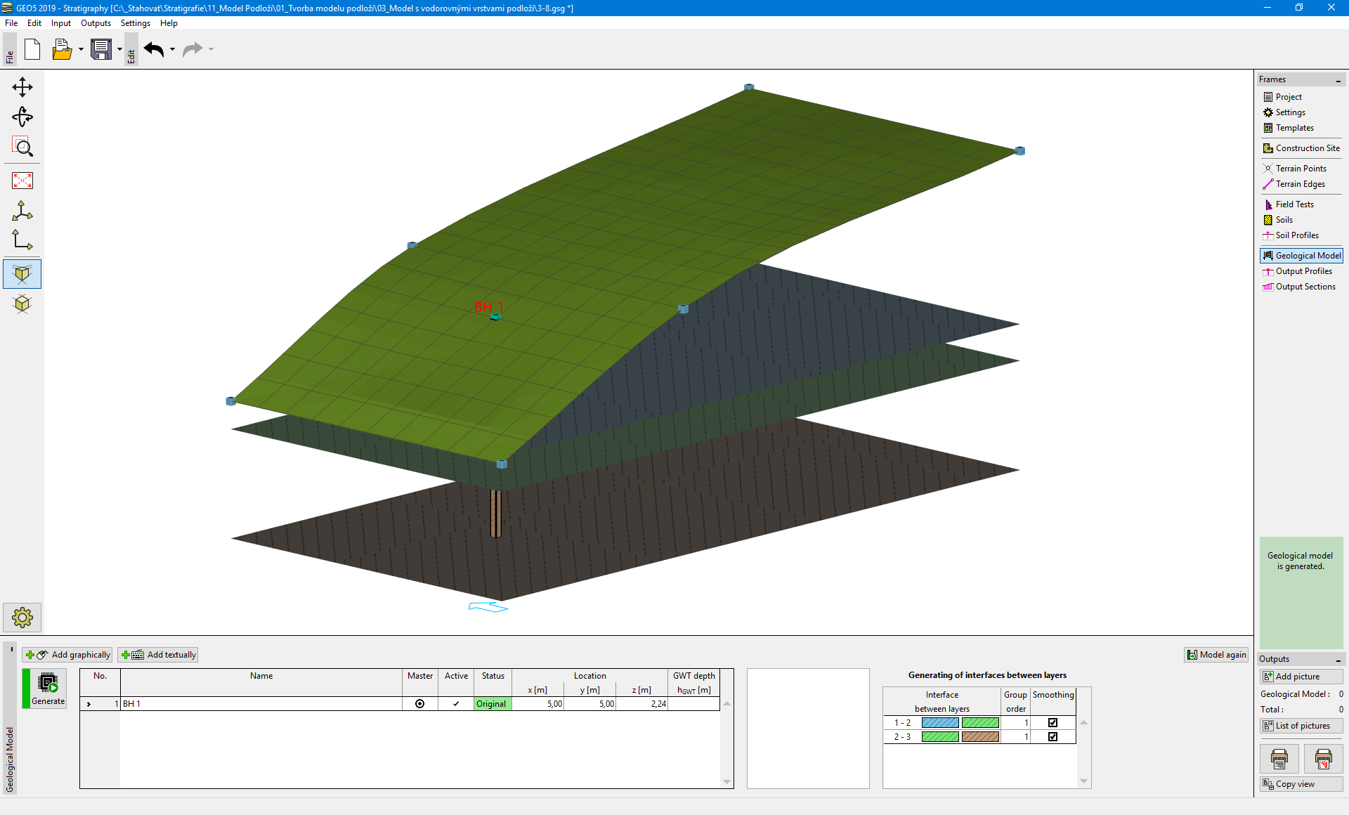 Generated model
For a clearer view, it is appropriate to enter a cross section in the frame "Output Sections" - points [x; y] - [0; 5], [20; 5].
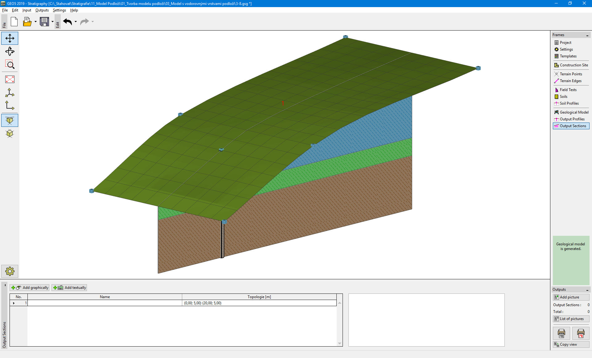 Visualisation of the model using Cross section
It is necessary to change the drawing settings for correct visualization of cross section in the "Geological Model" frame.
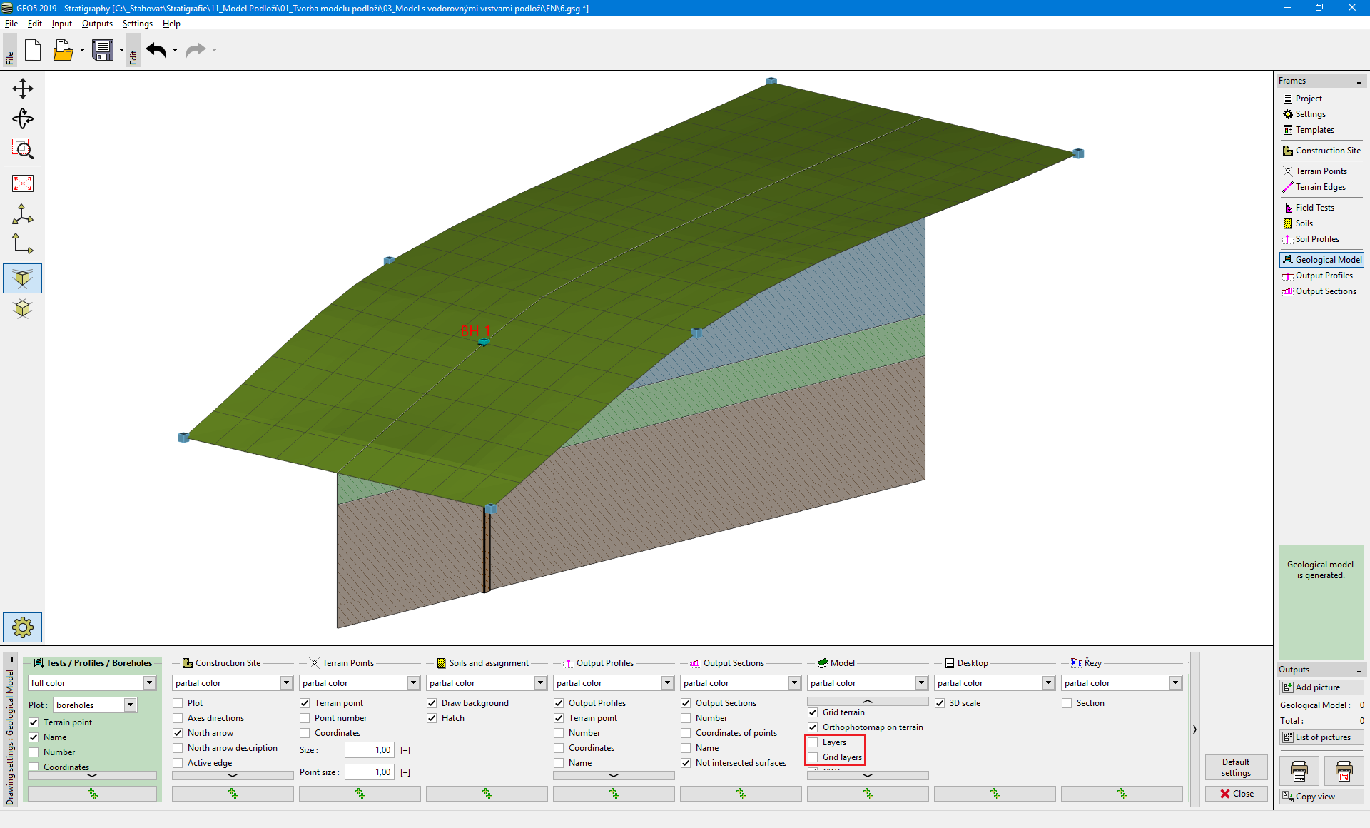 Frame "Geological model" - drawing settings