Water
The frame "Water" serves to specify the ground water table (GWT). A combo list "Type of water" contains the following items:
- No water - no water specified
- Water specified by points - the GWT points are defined in the table in the same way as when defining terrain points. This approach is particularly suitable if having a horizontal water table - then it is sufficient to define only one point of a given coordinate Z and the program automatically generates a horizontal line representing the GWT.
- Water specified in boreholes - Ground water is defined within boreholes. A particular depth of GWT measured from terrain surface is specified. This approach is suitable when boreholes with measured depths of GWT are available.
Visualization of drawing on the desktop can be modified in any input regime based on the setting adjusted in the "Drawing Settings" frame and with the help of buttons on tool bar "Visualization".
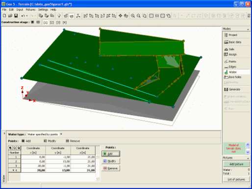 Frame "Water"